An inland sea lost to time
At the peak of the last ice age, roughly 14,000 years ago, a vast body of water sprawled across more than 50,000 square kilometers of what is now Utah, Nevada, and Idaho. Lake Bonneville — named after the American explorer Benjamin Bonneville — rivaled today's Lake Michigan in surface area, with water levels at times exceeding 300 meters above the flat salt expanses visible today. It was among the largest lakes in North America during the Pleistocene epoch.
As temperatures gradually rose following the last glacial maximum, the hydrological balance that sustained the lake collapsed. With no significant outlet and increasing evaporation, the lake shrank over millennia until only remnants remained. The most recognizable of these is the Great Salt Lake — itself now experiencing dramatic decline due to water diversion and prolonged drought. What the retreating waters left behind were broad, pancake-flat expanses of salt and sediment known as playas, which have become some of the most recognizable and studied landscapes in the western United States.
What satellites see that eyes cannot
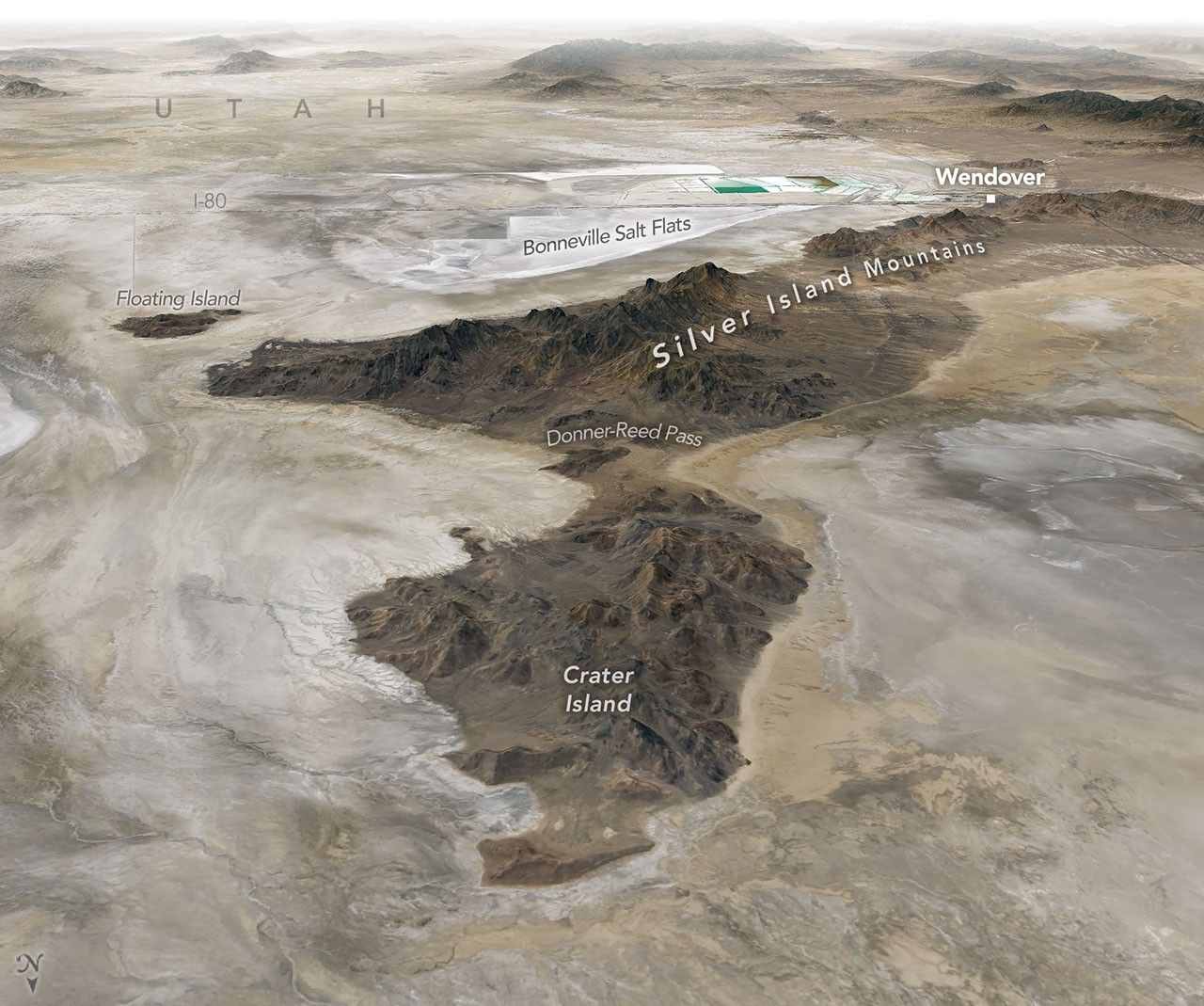
NASA recently published new Earth observation imagery of the Bonneville Salt Flats and surrounding terrain, captured by orbital instruments designed to monitor land surface changes over time. The images bring into sharp focus the ancient shoreline terraces etched into the flanks of nearby mountain ranges — layered geological records of the lake's fluctuating levels across thousands of years.
From orbit, the geometry of these features is unmistakable. The successive benches carved by wave action into the Wasatch Range and other nearby highlands tell a story of prolonged stability at certain water levels, separated by periods of rapid retreat. Geologists and hydrologists are using this satellite data alongside ground-based measurements to reconstruct past climate conditions and refine projections for a region facing mounting water stress in the coming decades.
A landscape that tests human limits
The human story written across these ancient lake beds is as compelling as the geological one. Indigenous peoples traversed and inhabited the margins of these arid flats for thousands of years, developing deep knowledge of their rhythms and resources. When Euro-American explorers and emigrants pushed westward in the nineteenth century, crossing the salt desert became one of the most feared and frequently fatal legs of overland journeys. Journals from that era document disorientation, dehydration, and the loss of livestock to the relentless white expanse.
In the twentieth century, the same landscape attracted a very different kind of adventurer. The extraordinary flatness and firmness of the Bonneville Salt Flats made them ideal for land speed record attempts, drawing engineers and drivers from around the world. Vehicles ranging from purpose-built streamliners to jet-powered machines have been pushed to their mechanical limits across the same terrain that once lay beneath hundreds of meters of water.
Today, the salt crust itself is under threat. Years of groundwater extraction, reduced precipitation, and rising temperatures have thinned the surface that made these records possible. What NASA's sensors are documenting is not merely a geological curiosity but a living record of environmental change — an ancient lake's final chapter still being written, one dry season at a time.