Ten sensors, one city, a mounting health crisis
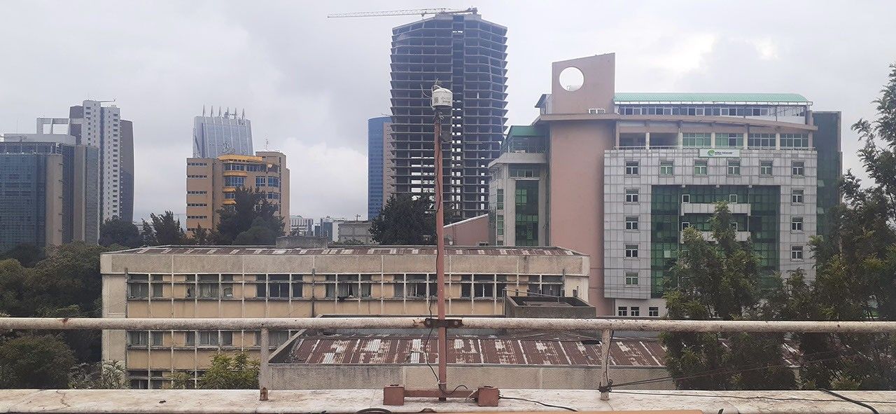
Across the rooftops of Addis Ababa, ten compact monitoring devices are quietly measuring something invisible and deeply consequential. Deployed as part of NASA's MAIA mission — short for Multi-Angle Imager for Aerosols — these instruments track concentrations of PM2.5, the class of airborne particles with a diameter of 2.5 micrometers or smaller. That is roughly thirty times finer than a human hair, small enough to bypass the body's natural respiratory defenses, penetrate deep into lung tissue, and enter the bloodstream. Long-term exposure to PM2.5 is linked to cardiovascular disease, chronic lung conditions, and premature death, making it one of the most significant environmental health risks globally.
Addis Ababa was selected as a priority study site for compelling reasons. Ethiopia's capital is experiencing rapid urban growth, a sharp rise in vehicle traffic, and expanding industrial activity — all of which drive elevated particulate levels. Reliable, fine-grained air quality data for the city has historically been scarce, leaving health authorities and researchers with limited tools to assess exposure or design effective interventions.
Three years of ground-level data, read from space
Over a period of three years, the sensor network logged continuous measurements across different neighborhoods, capturing how pollution levels shift by location, season, and time of day. Those ground readings are then integrated with observations collected by the MAIA satellite, developed at NASA's Jet Propulsion Laboratory. The orbiting instrument observes aerosols from multiple angles simultaneously — a technique that enables scientists to distinguish between different particle types, including mineral dust, combustion soot, and secondary aerosols, with a level of specificity that neither ground sensors nor standard satellites can achieve independently.
The resulting maps represent what NASA describes as one of the most granular depictions of urban air pollution ever produced for an African city. By overlaying pollution gradients onto residential and commercial districts, researchers can begin to identify which communities bear the greatest exposure burden — a prerequisite for linking air quality to public health outcomes in those same areas.
From satellite science to real-world health policy
Addis Ababa is one node in a broader global program. MAIA is designed to study multiple cities worldwide, with a particular focus on urban centers in regions where air quality monitoring infrastructure is weak and populations face disproportionately high exposure. The mission's ultimate aim is to give epidemiologists and public health officials the kind of robust, spatially resolved data they need to quantify how pollution affects mortality and disease rates in specific communities.
This hybrid methodology — merging orbital remote sensing with dense surface measurements — marks a meaningful shift in how space science can address terrestrial public health challenges. As climate change is expected to intensify some sources of atmospheric pollution in coming decades, the relevance of programs like MAIA is likely to grow. The open question, however, remains whether the institutions that receive this data will have both the capacity and the political will to translate scientific findings into tangible improvements in air quality for the people living beneath these sensors.