In the opening months of 2026, NASA's Perseverance rover has been pushing further west than any spacecraft has ever traveled on Mars. The agency released a series of striking images on May 12, 2026, documenting this campaign: two self-portraits taken weeks apart, and a sweeping panorama recorded at a site the science team nicknamed "Arbot."
Selfies as Scientific Milestones
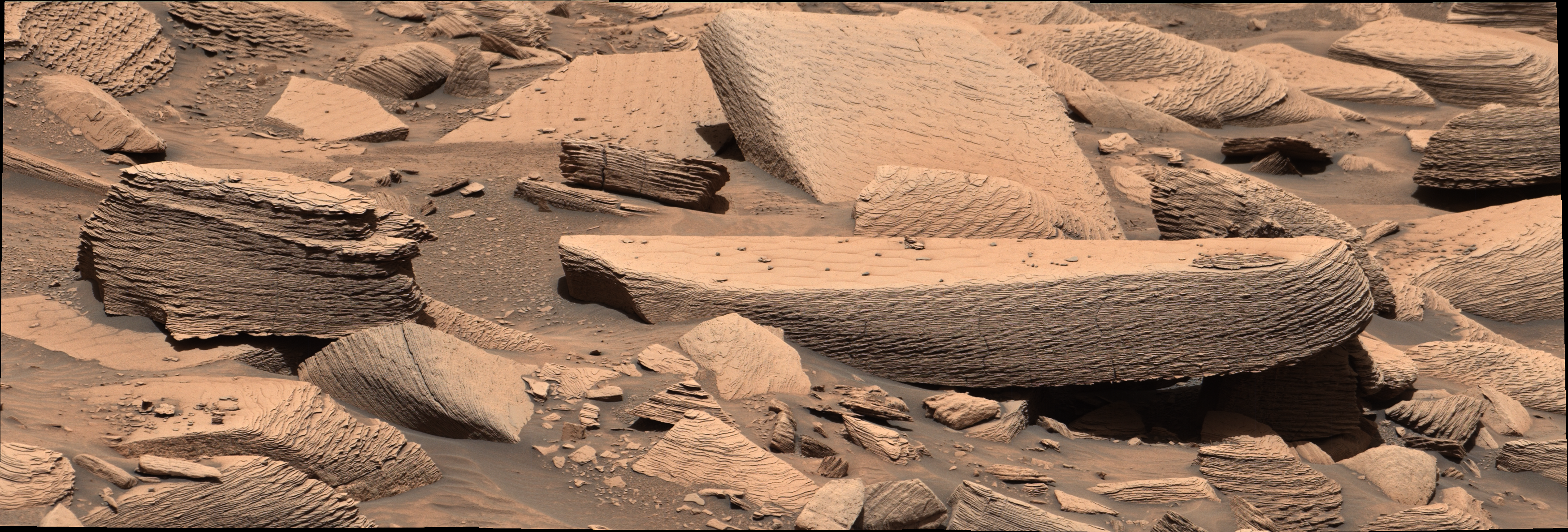
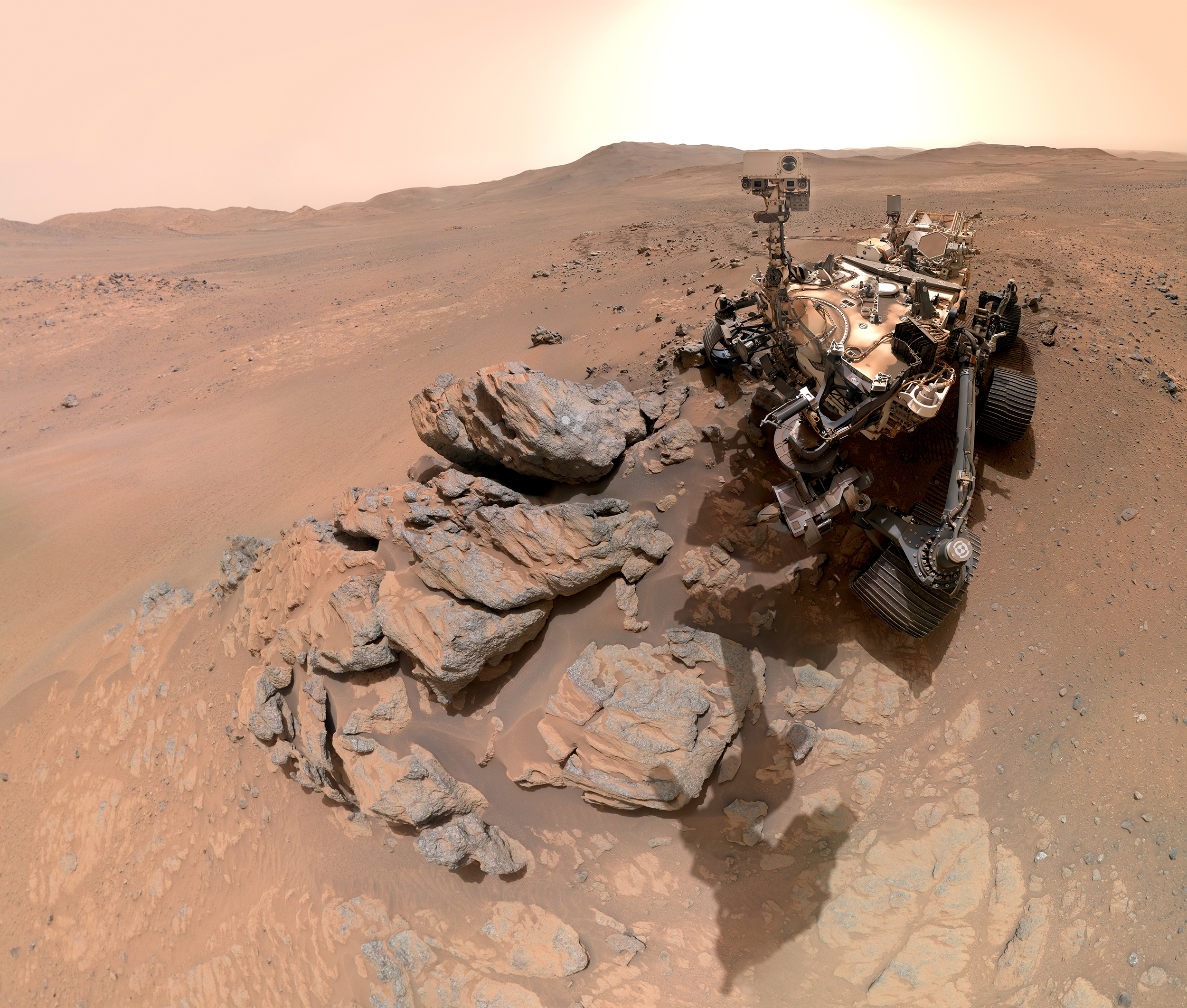
The first self-portrait was acquired on March 11, 2026 — sol 1,797 of the mission, a sol being one Martian day lasting roughly 24 hours and 37 minutes. Combining 61 individual frames from the WATSON camera at the end of the robotic arm and the mast-mounted Mastcam-Z, the image shows Perseverance with its mast directed toward a rocky outcrop called "Arethusa," where the rover had just completed a circular abrasion. The resulting whitish patch stripped away the weathered surface layer, exposing fresh rock interior for analysis by the rover's onboard instruments.
Weeks later, a second selfie captured Perseverance at a location the team named "Lac de Charmes" — site names for Perseverance are drawn from a variety of cultural and geographic references. Once again assembled from 61 images, the portrait shows the rover's mast aimed at a newly abraded rocky target, with the western rim of Jezero Crater stretching across the background under a pale Martian sky.
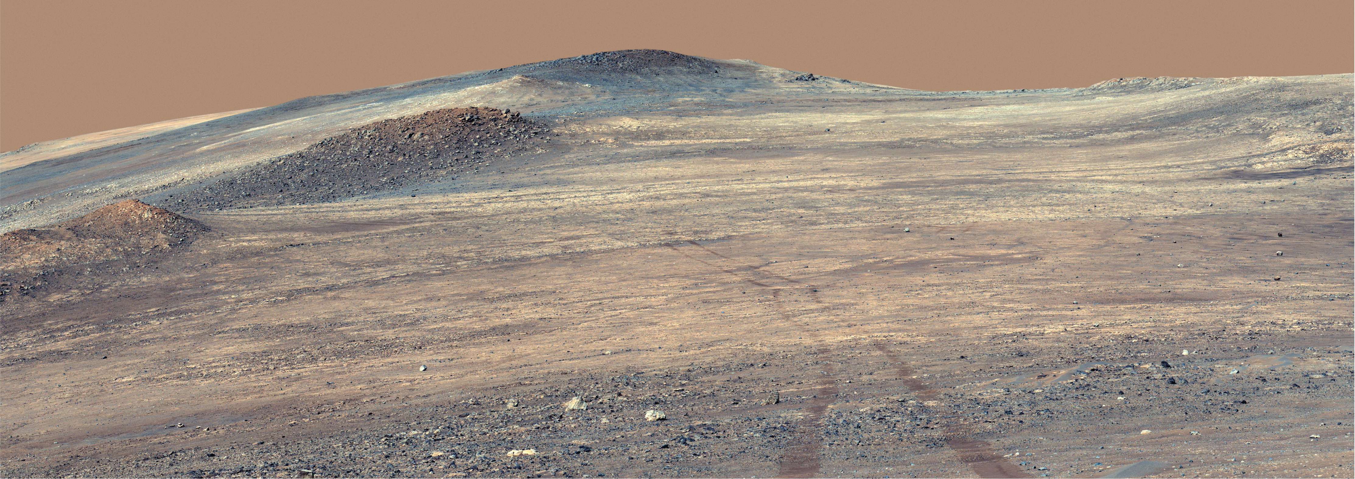
The Arbot Panorama: A Rich Window Into Mars' Past
Between those two selfies, Mastcam-Z assembled a 46-image panorama of the Arbot site on April 5, 2026, at sol 1,882. NASA describes this view as one of the most geologically detailed vistas the rover has produced since its February 2021 landing. The rock formations in frame reveal a layered, complex history: interbedded sedimentary sequences, varying textures that may point to distinct depositional environments, and structures that planetary geologists will be working to interpret for years to come.
This westward push marks a deliberate strategic shift. Having spent much of its mission surveying the floor of Jezero Crater and its ancient river delta — widely regarded as one of Mars' most promising sites for preserved biosignatures — Perseverance is now venturing into terrain no spacecraft has ever examined. The rocks encountered here may predate those of the delta itself, potentially offering a window into the earliest chapters of Martian geological history.
Samples in Hand, But the Return Journey Remains Uncertain
Photography is only part of the story. Throughout its westward traverse, Perseverance continues to core and seal rock samples into metal tubes deposited on the Martian surface, building a scientifically curated cache intended for retrieval by a future return mission. That campaign, a joint undertaking by NASA and the European Space Agency (ESA), still faces unresolved questions around budget and schedule. A confirmed Earth-return date has yet to be announced.
For now, the images streaming back from these new frontiers serve as preliminary maps of terrain that science is only beginning to understand. Each abraded patch of rock, each panorama stitched together from dozens of frames transmitted across hundreds of millions of kilometers, edges humanity a little closer to answering the question that has driven Mars exploration for decades: did life ever take hold on the red planet?