Into uncharted ground
NASA's Perseverance rover has been steadily pushing into territory it has never visited before — the ancient landscape lying west of Jezero Crater. Since early 2026, the rover has made its deepest incursion yet in that direction, traversing terrain that scientists had previously studied only from orbital imagery. What Perseverance is now seeing up close is offering a far more detailed picture than any satellite could provide.
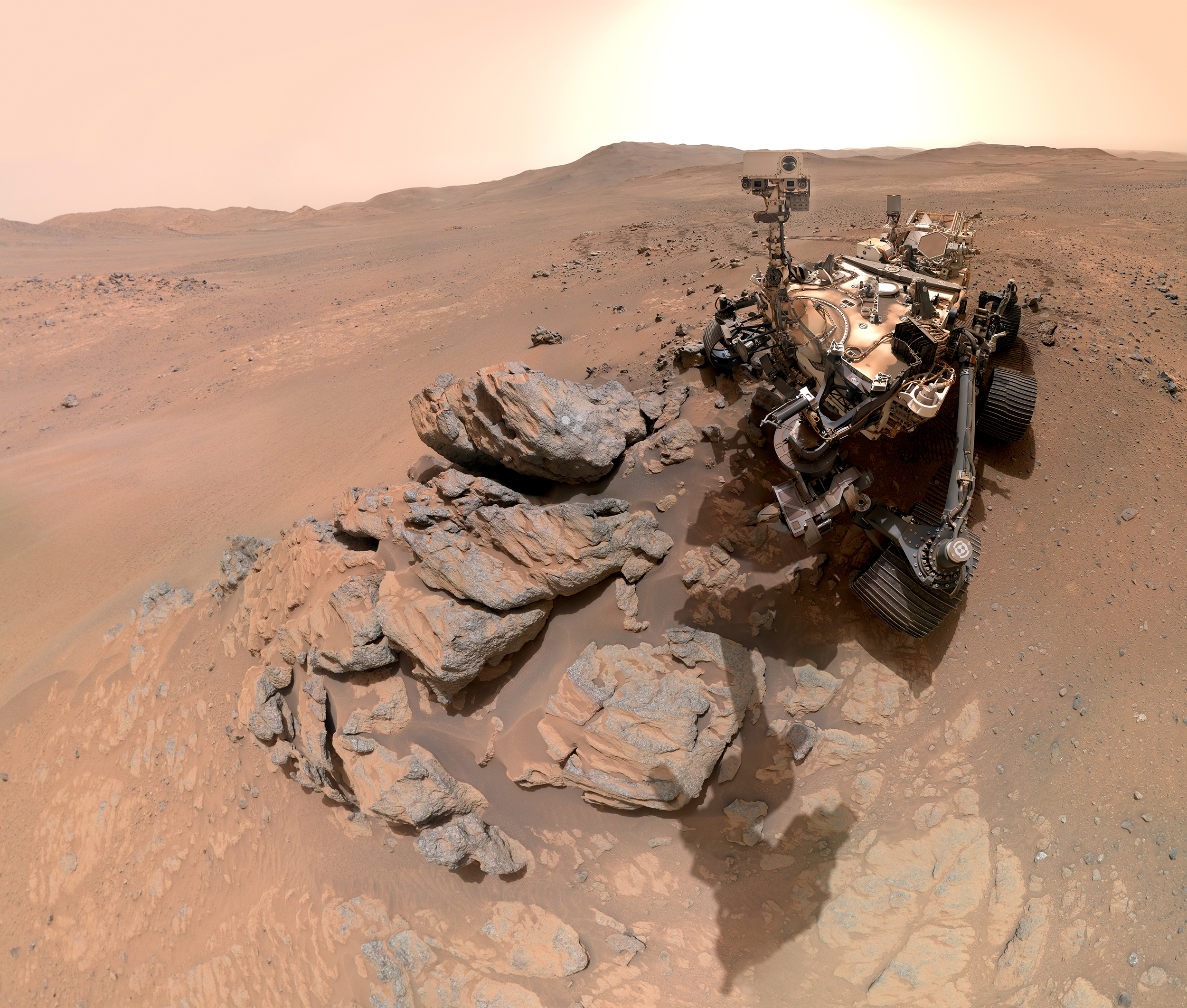
On sol 1,797 of the mission — March 11, 2026 — the rover paused at a rocky outcrop the team named Arethusa to take a self-portrait. The image, stitched together from 61 individual frames, shows Perseverance's mast camera aimed directly at the rock face, where the rover had just completed one of its signature circular abrasion patches, leaving a pale, freshly exposed surface. These abrasions are a key part of the rover's workflow: removing the weathered outer layer of rock allows onboard instruments to analyze the unaltered mineral composition beneath.
Arbot and Lac de Charmes: reading Mars in layers
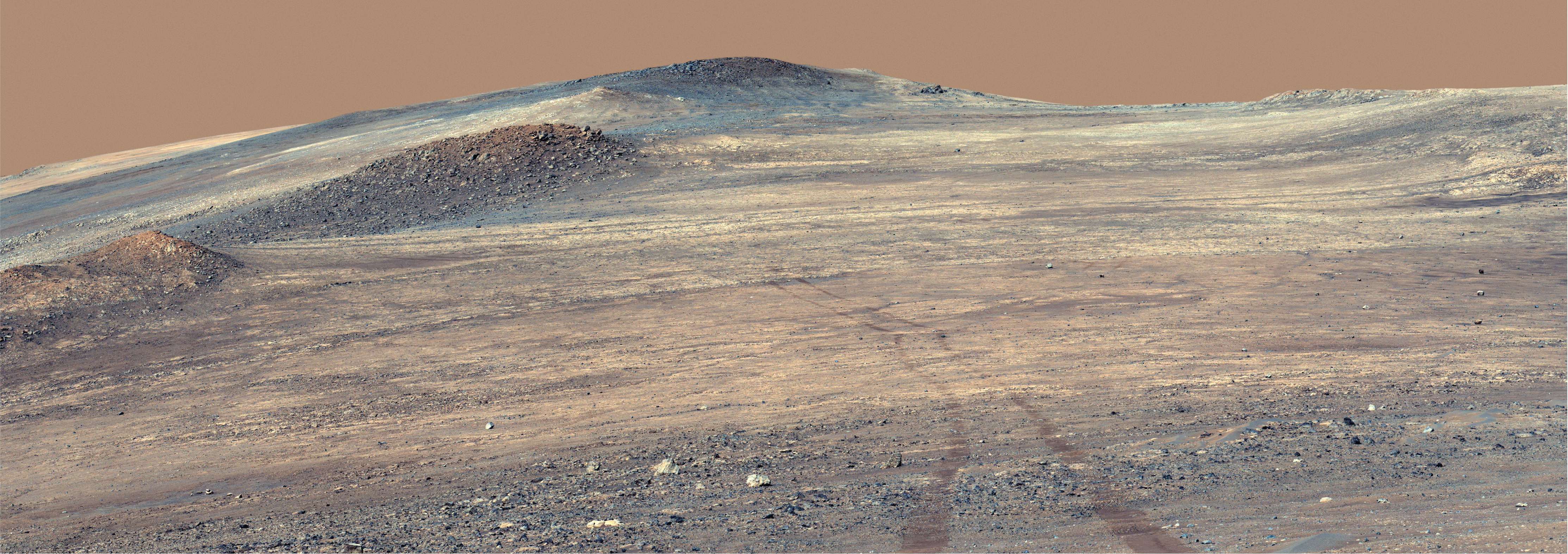
On sol 1,882 — April 5, 2026 — Perseverance deployed its Mastcam-Z camera system to photograph a location nicknamed Arbot. The resulting 46-image panorama is one of the most geologically detailed wide-angle views captured during this western traverse. The exposed rock layers hint at a complex history, possibly tied to ancient volcanic activity or long-vanished bodies of liquid water.
A subsequent selfie, taken at a site the science team calls Lac de Charmes, continues this visual record of the rover's journey. Once again assembled from 61 images, the portrait shows Perseverance in front of a freshly abraded rocky surface, with the western rim of Jezero Crater visible in the background — a subtle reminder of how far the rover has traveled from its original landing zone.
More than a photograph
These images serve a purpose well beyond documentation. Each selfie and panorama gives mission engineers a chance to assess the rover's mechanical condition and helps scientists map the geological context of every sample site and abrasion. Instruments such as PIXL, SHERLOC, and SuperCam depend on this spatial context to interpret their measurements accurately.
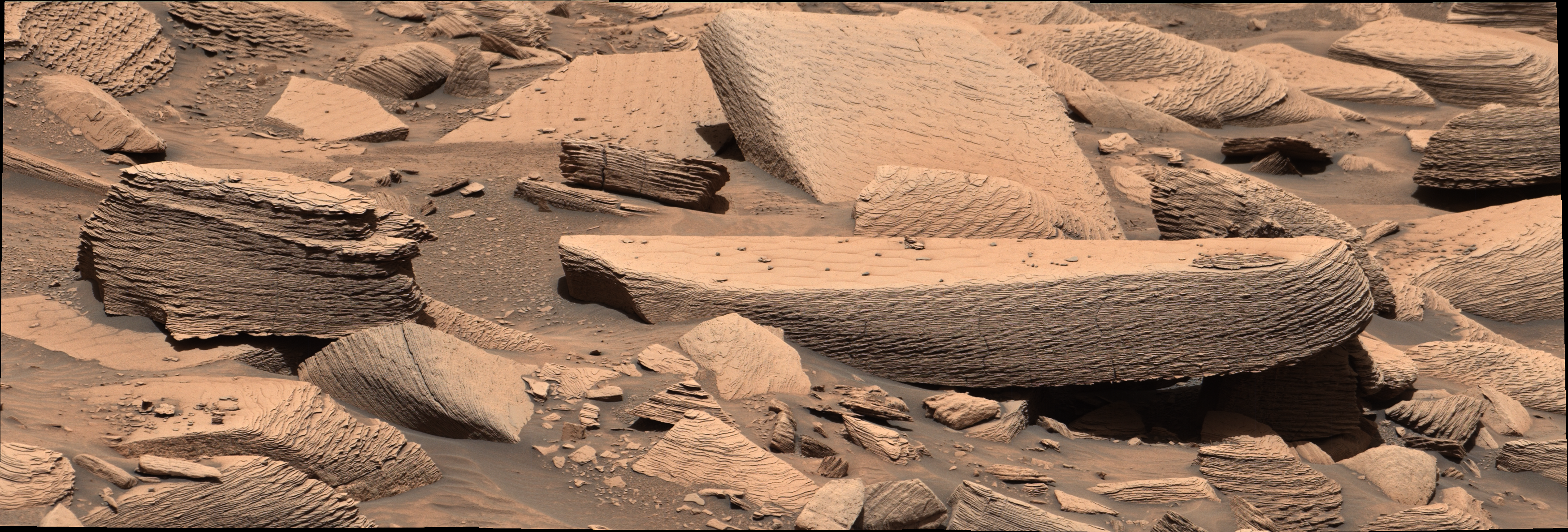
The terrain west of Jezero is of particular interest because it may contain rocks older than those found inside the crater itself. Establishing the geological timeline of this region is central to one of the mission's core questions: whether Mars ever hosted conditions suitable for microbial life. Older rocks, if well-preserved, could hold chemical or mineralogical signatures that younger formations may have since erased.
NASA has not publicly outlined how much farther west Perseverance is expected to travel. What is clear is that each new sol brings the rover into ground that no spacecraft has examined at surface level — and that every image sent back, whether a panoramic sweep or a close-up selfie, adds another data point to humanity's slowly growing understanding of a neighboring world.